About Strath Creek
Located in the Shire of Murrindindi in central Victoria, Strath Creek is 104km north of Melbourne.
Strath Creek itself flows into the King Parrot Creek in the north.
There are 231 residents in Strath creek and the surrounding areas according to the 2021 census.
Pre Colonial
Strath Creek Area Indigenous Heritage.
The area of Strath Creek is the traditional land of the Taungurung language group, part of the wider Kulin nation that occupied a wide area including Melbourne and much of central Victoria. A detailed account of indigenous heritage can be found in the “Murrindindi Shire Heritage Study — July 2011” which can be found on the Murrindindi Council website.
Post Colonial
Hume and Hovell trekked through the Strath Creek valley enroute to Mt Disappointment in 1824. An historic cairn can be seen on the main Broadford Rd. just outside the town. Overlanders from NSW along with their sheep arrived in the Strath Creek Valley between1839 and 1842. Two large squatting runs were established, “Kurysdale” later named “Kerrisdale” by John Murchison and “Flowerdale” by Roderick MacKenzie.
Changes to various Land Acts in the 1860’s enabled people to “Select” various tracts of land that had been previously managed by the squatters and many families took this opportunity. Selections were often amalgamated into larger farms and worked by multiple family members.
Mining Surveyor Reports about this time indicated many were looking for gold in the district. Mining Companies were floated; activity and fortunes fluctuated.
Water was always a problem, either a lack of it or mines flooded, especially those in what later became the township area.
Steve Baker had a race and water wheel on the Strath Creek which he worked for many years. This wheel has been restored, is operational today, and can be seen in the township Reserve.
From earliest times sheep were the mainstay of farming activity with a few cattle added to the mix. A number of small dairy herds supplied cream to the Butter Factory and Creamery that had been established, however these were short lived.
Murchison Hill, named after John Murchison, was a significant barrier to travel and prevented easy access to Broadford in the west.
Cutting works were undertaken between 1882-4; even then it took about a day to travel to Broadford. On the return journey saplings were needed to act as brakes to slow the descent down the steep hill.
The Township as we know it was mapped in 1880 and officially proclaimed Flowerdale Township in 1884. Locals rarely used this name, preferring Strath Creek, and it was officially altered in 1909.
The Township developed, a store and Good Templars Hall were built followed by a Creamery and Black Smith.
In 1893 the original school that had been established in the north end of the valley was moved to the township so that a greater number of school aged children would be able to access an education.
The last store to be built was in 1909, the same year the Community Hall was built. We are fortunate to have a new general store being constructed in 2023 on the same corner site following the destruction by fire of the old store some years ago.
The Hall ( extensively renovated with bushfire recovery finance after the devastating 2009 bushfires ), and community Church, originally the Good Templars Hall are all that remain of those early buildings.
A Heritage wall acts as a gateway to the Pioneer Reserve and displays a number of plaques remembering some of the families that have lived in the Strath Creek area in more recent history.
( Source material — Noreen Foster ” Whispers in the Valley” )
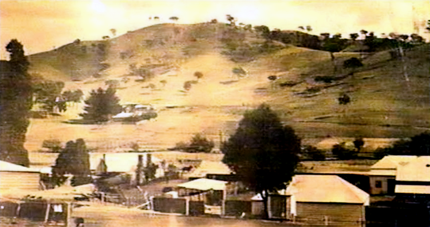
Strath Creek 1908
Sunset Photo by Cass Groves